Facilities and locations
A Location is any fixed place your agency cares about: a station, a hospital, a helispot, a trailhead. Each one has a Location Type. The Facilities tab shows the same Locations three ways.
| Tile | Use it to |
|---|---|
| Facilities | See every Location in one table, import many from a map layer, and change many at once. |
| Stations | See only the Locations whose type is a station type, with their code, district and what is based there. |
| Locations | Add or edit one Location at a time. |
| Location Types | Manage the list of types. |
Facilities
Where: FacilitiesFacilities
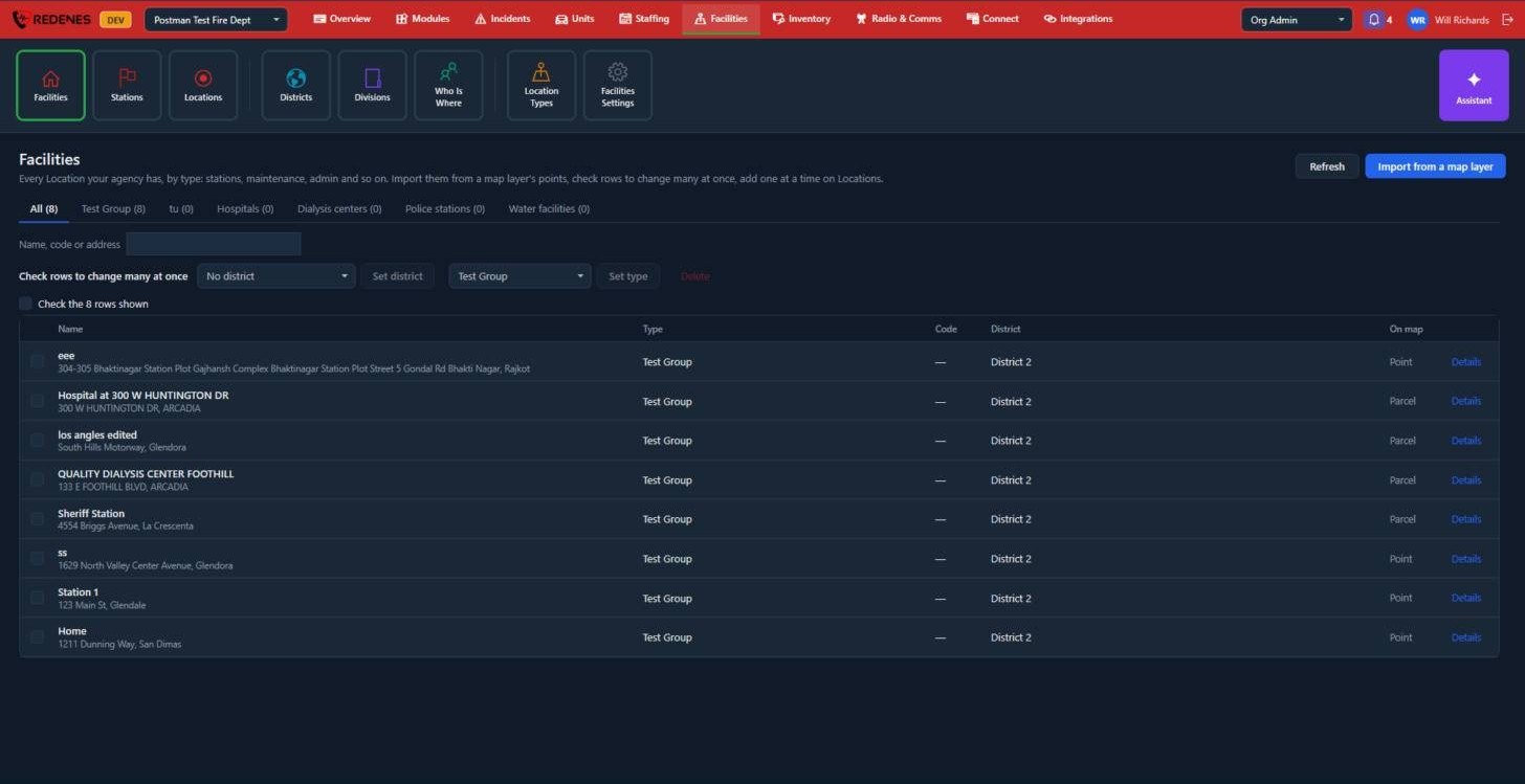 12345
- Type tabs 1: All, then one tab per Location Type with its count.
- Search 2 by name, code or address.
- Change many at once 3: check the rows (or Check the rows shown), then pick a district and click Set district, pick a type and click Set type, or click Delete.
- Import from a map layer 4: turns each point of a map layer into a Location. You choose the layer, the Location Type, and which of the layer's data keys hold the name, code and address. Layers come from Zones & Layers.
- Details 5 opens one facility: its address, contacts, worksheet buttons and floor plans.
The On map column says whether the facility is drawn as a Point or as a Parcel (the outline of its property).
Details of a facility
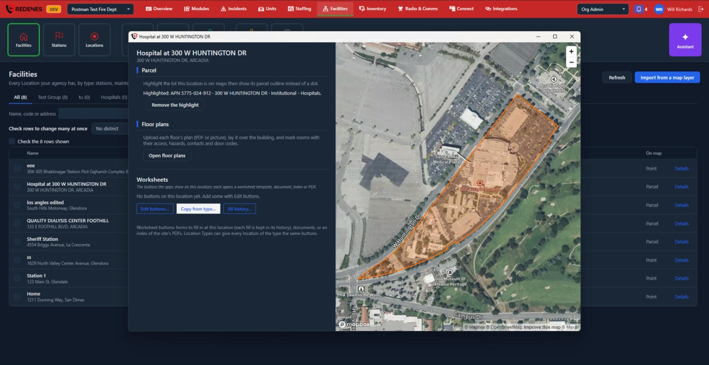 1234
- Parcel 1: highlight the lot the facility is on. Maps then show the outline of the property in place of a dot. Remove the highlight goes back to a dot.
- Floor plans 2: Open floor plans opens the floor plan window, below.
- Worksheets 3: the buttons the apps show on this location. Edit buttons changes them, Copy from type takes the buttons of its Location Type, and All history lists every form filled in here.
- The map 4 shows the facility and its parcel.
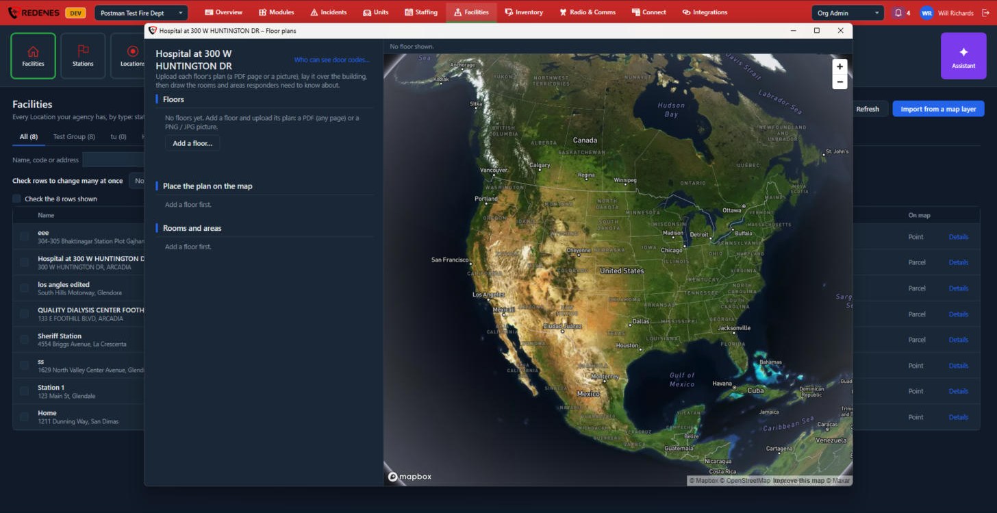 1234
- Floors 1: click Add a floor and upload its plan, a PDF page or a PNG or JPG picture.
- Place the plan on the map 2: lay the plan over the building so it lines up.
- Rooms and areas 3: draw the rooms and areas responders need to know about, with their access, hazards, contacts and door codes.
- Who can see door codes 4 sets which members see them. Everyone else sees the room without its code.
Import from a map layer
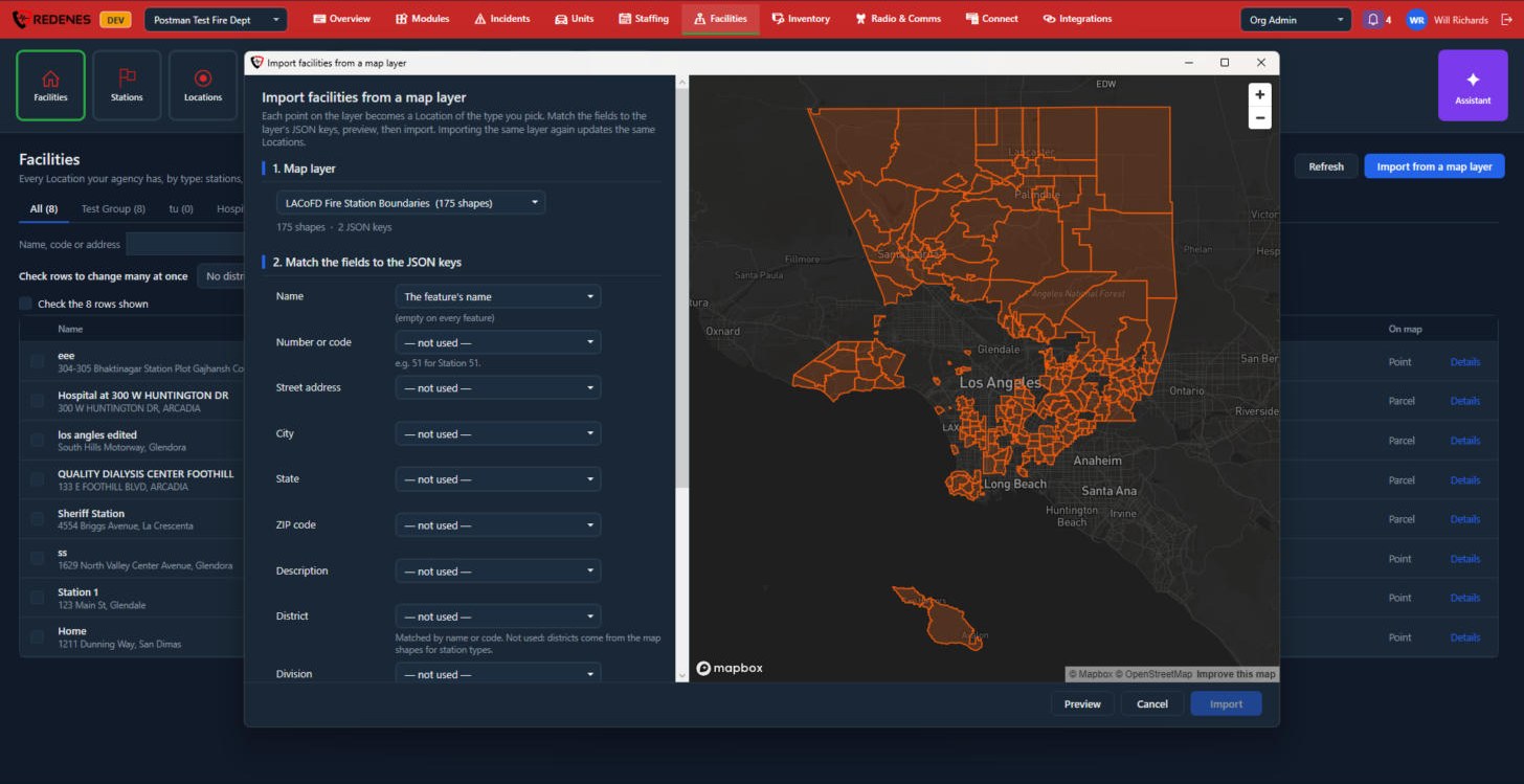 1234
- Pick the Map layer 1. The line under it says how many shapes and data keys it has, and the layer is drawn on the map 3. Click a feature on the map to see all of its keys and values.
- Match the fields 2: for Name, Number or code, Street address, City, State, ZIP code, Description, District and Division, pick the key in the layer that holds it, or leave it not used.
- Scroll down to Options: the Location Type every imported feature gets, whether to update Locations already imported from this layer, whether to add districts and divisions that do not exist yet, and whether shapes become Locations at their middle.
- Click Preview 4 to see what each feature will do before anything is saved, then Import.
Importing the same layer again updates the Locations it made before, so you do not get doubles.
Stations
Where: FacilitiesStations
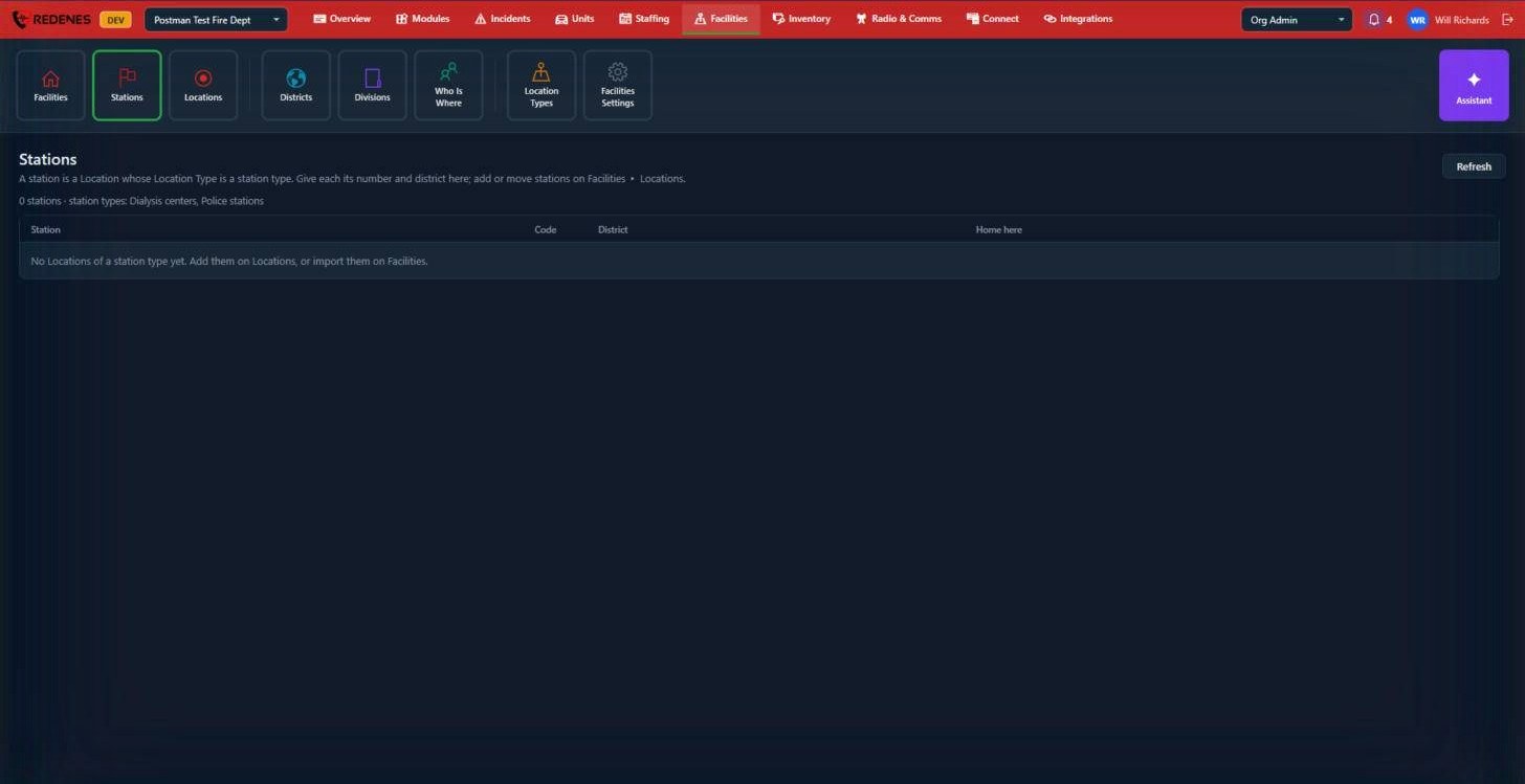 12
A station is not a separate thing. It is a Location whose type you marked as a station type in Facilities Settings. The line under the title 1 tells you which types count.
For each station the table 2 shows its Code (the station number), its District, and under Home here the units, members, posts, displays and devices based at it. Set those on Who Is Where.
If the list is empty, either no Location has a station type yet, or no type is checked in Facilities Settings.
Locations
Where: FacilitiesLocations
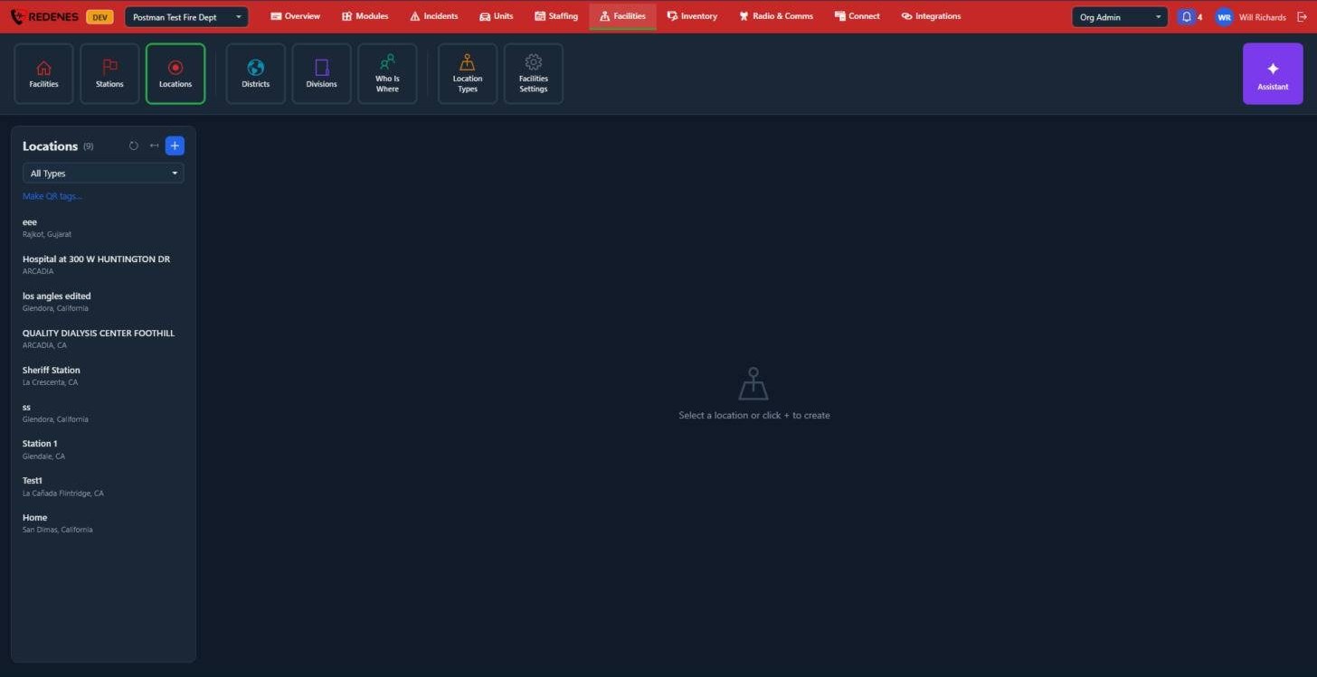 1234
- Click + 1 to add a Location. Give it a name, a type and an address, or drop its pin on the map.
- Filter the list by type 2.
- Make QR tags 3 prints a QR code for each Location. Scanning one in the app opens that Location.
- Click a Location in the list 4 to edit or delete it.
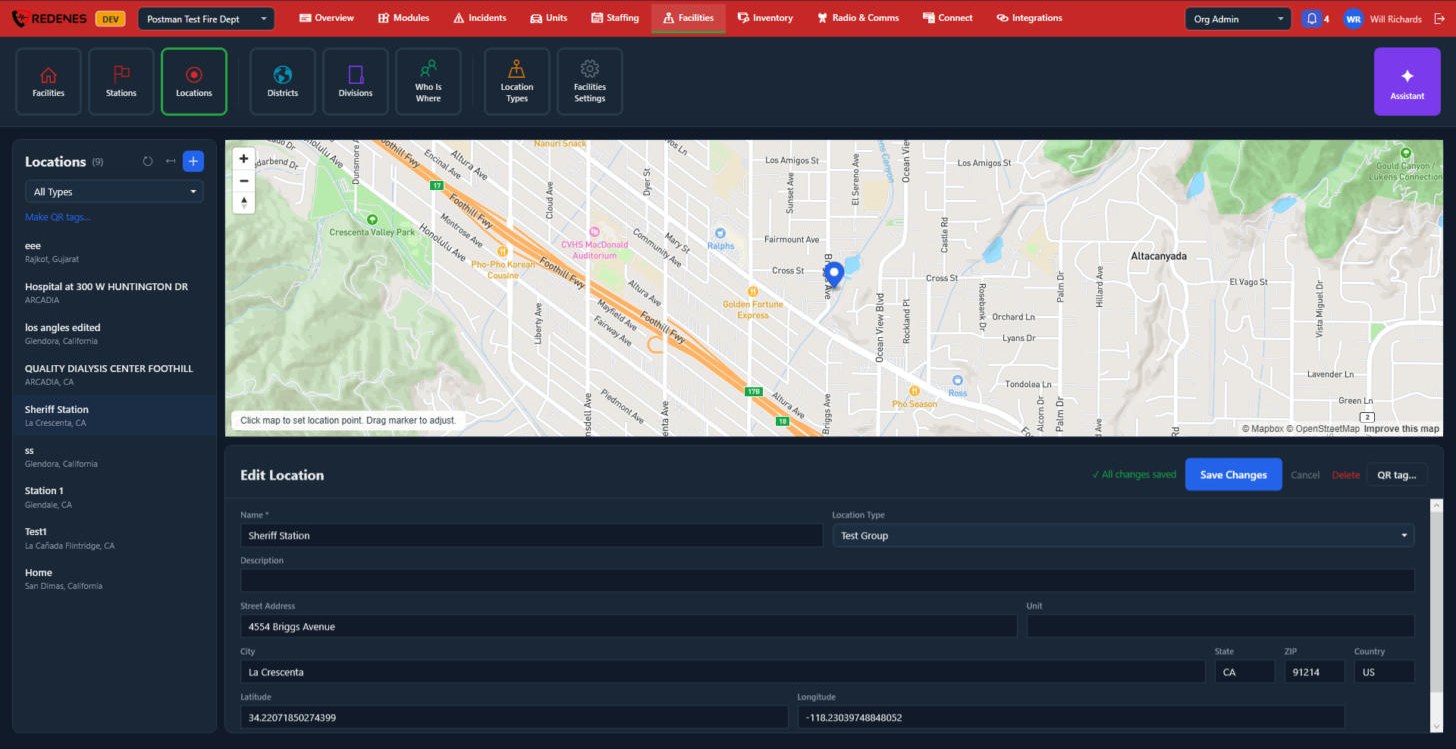 1234
- The map 1: click to set the point, or drag the marker to adjust it.
- Save Changes, Cancel, Delete and QR tag 2. QR tag shows this Location's own QR code.
- Name, Location Type and Description 3.
- The address, and the Latitude and Longitude the pin is at 4. Scroll down for Enabled in app, which hides the Location from the apps when unticked.
Location Types
Where: FacilitiesLocation Types
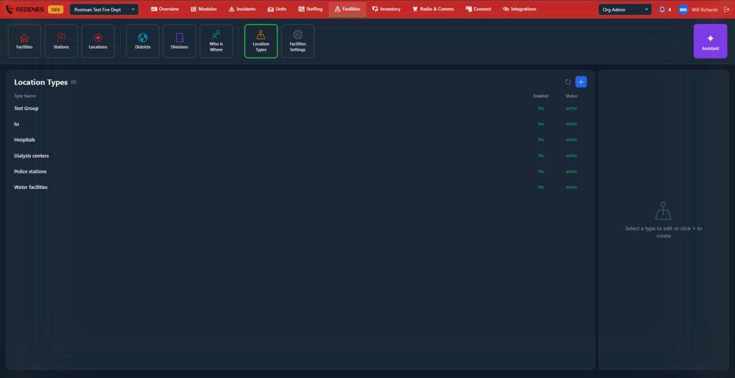 12
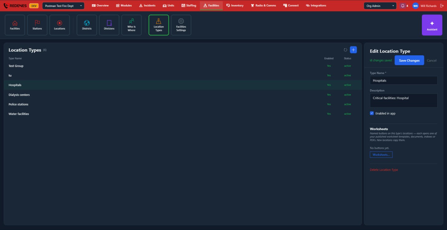
Click + 1 to add a type, or click a type 2 to rename it, turn it off or delete it. A type that is not Enabled stays on existing Locations but cannot be chosen for new ones.
 1234
- Type Name, Description and Enabled in app 1.
- Worksheets 2: named buttons on every Location of this type. Each opens one of your published worksheet templates, documents, indexes or PDFs. New Locations copy them.
- Delete Location Type 3.
- Save Changes or Cancel 4.