Zones and Layers
Layers are the shapes drawn on top of the map: district boundaries, evacuation zones, response areas, trails, hydrants.
Where: ModulesZones & Layers
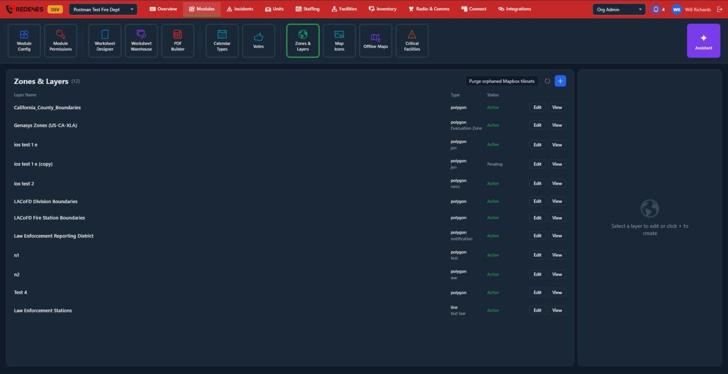 123
Add a layer
- Click + 3.
- Upload a GeoJSON file. Most mapping tools and county GIS sites can export one.
- Name the layer and choose its colors and which property labels each shape.
Reading the list
- Type 1: polygon (areas), line or point. A second line shows what the layer is used for, such as Evacuation Zone.
- Status: Active layers are on the maps. Pending layers are still being processed.
- Edit and View 2: change a layer, or open it on a map.
Layers are also used elsewhere in Org Admin: districts take their shapes from a layer, and radio channel types can follow one.
A layer's settings
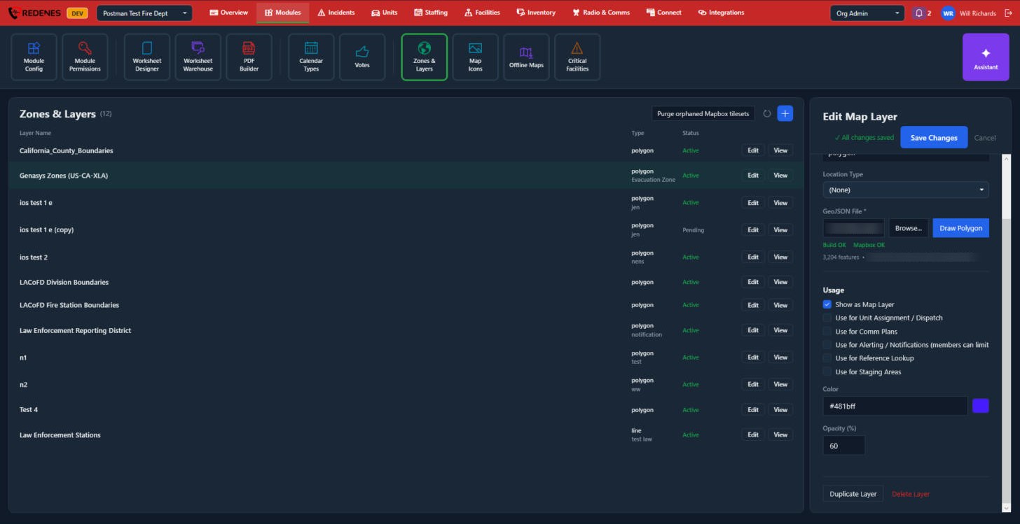
Click a layer's row.
 12345
- Layer Name, Layer Type and Location Type are at the top of the panel.
- GeoJSON File 1: Browse uploads a new file. Draw Polygon lets you draw the shape yourself. The line below shows whether the file was built and how many shapes it has.
- Usage 2: what the layer is for.
| Tick | Meaning |
|---|---|
| Show as Map Layer | Members can switch it on in the maps. |
| Use for Unit Assignment / Dispatch | Its areas decide which units belong to a location. |
| Use for Comm Plans | Its areas pick the radio plan for a location. |
| Use for Alerting / Notifications | Members can limit their alerts to its areas. |
| Use for Reference Lookup | Its areas can be looked up by address or location. |
| Use for Staging Areas | Its shapes are offered as staging areas. |
- Color and Opacity 3.
- Duplicate Layer and Delete Layer 4.
- Edit and View 5 on each row: see below.
Click Save Changes at the top of the panel.
Edit the shapes
 123
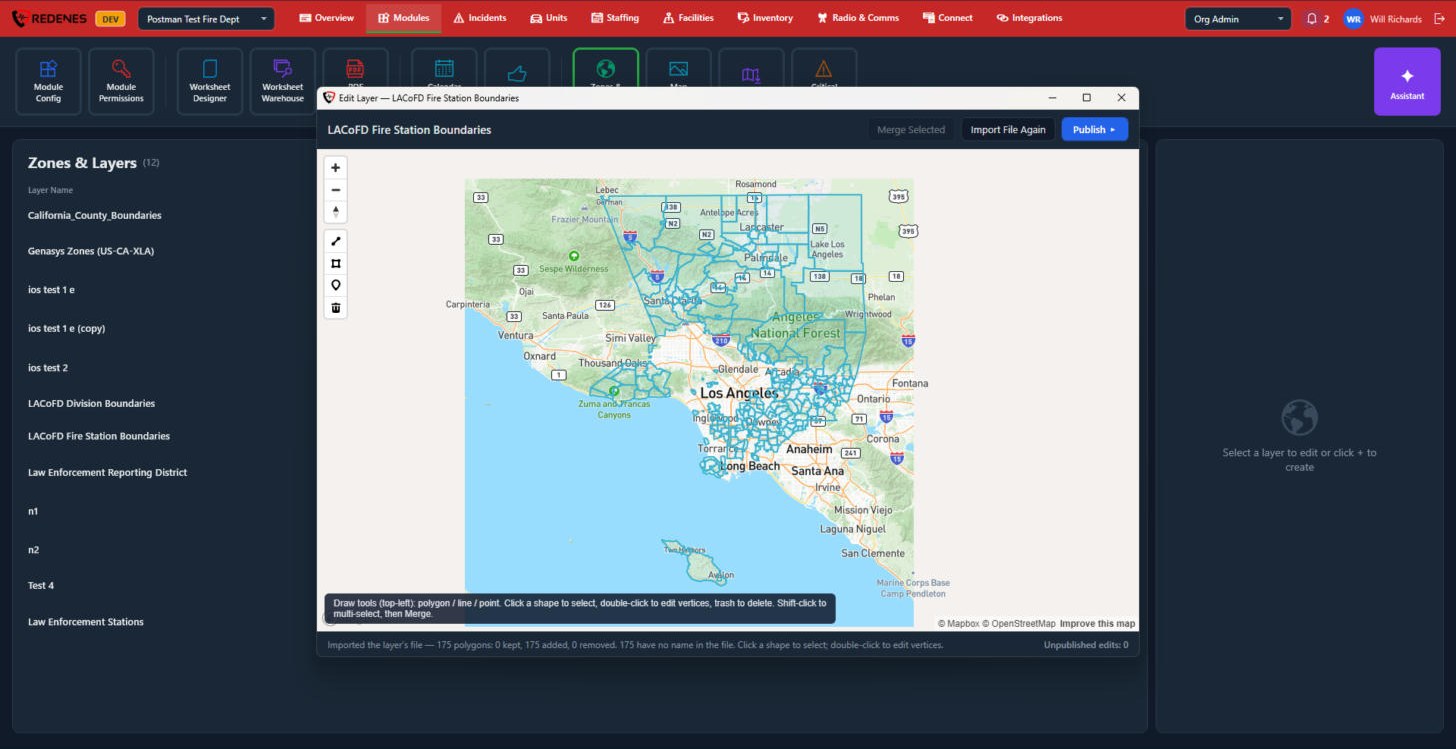
- The tools on the left 1: zoom, then draw a line, a polygon or a point, and the bin. Click a shape to select it, double-click to move its corners, and use the bin to delete it.
- Hold Shift and click to select several shapes, then Merge Selected joins them. Import File Again reloads the shapes from the layer's file. Publish sends your changes to the maps 2.
- The line at the bottom 3 counts the shapes and your unpublished edits.
View opens the layer on a map without any tools.
Purge orphaned Mapbox tilesets, at the top of the list, clears out map data left behind by layers that were deleted. You rarely need it.