RF Maps
RF Maps predicts radio coverage from your sites, so you can see where a portable should work before you go there.
Where: Radio & CommsRF Maps
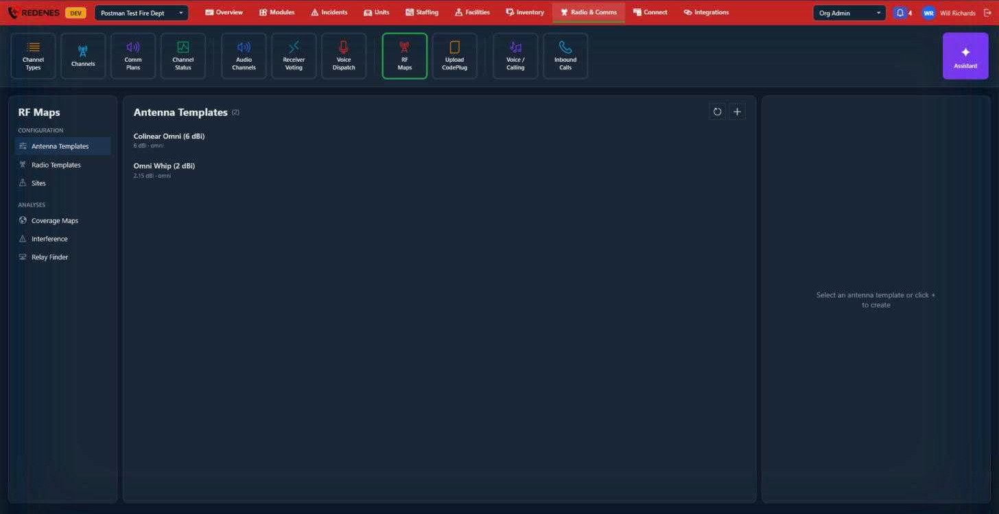 123
Configuration 1
Set these up first, in this order:
- Antenna Templates: each kind of antenna you use, with its gain and pattern (for example a 6 dBi omni).
- Radio Templates: each kind of radio, with its band, power and receive sensitivity.
- Sites: where the equipment is. A site has a position, an antenna height, and the antenna and radio templates it uses.
Click + 3 to add to whichever list is open.
Analyses 2
- Coverage Maps: draws the predicted coverage of one or more sites on the map, using the terrain.
- Interference: shows where sites on the same or nearby frequencies may interfere.
- Relay Finder: suggests where to put a temporary repeater to reach an area with no coverage.
A coverage map is a prediction from terrain and equipment figures. Trees, buildings and weather are not in it, so treat the edge of coverage as approximate and confirm important spots with a radio check.
Antenna Templates
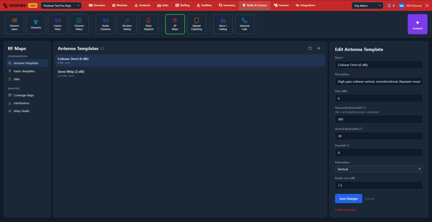 123
- The fields 1: Name, Description, Gain (dBi), Horizontal Beamwidth (360 is omnidirectional, less is directional), Vertical Beamwidth, Downtilt, Polarization and Feeder Loss (dB).
- Save Changes or Cancel 2.
- Delete Template 3.
Radio Templates
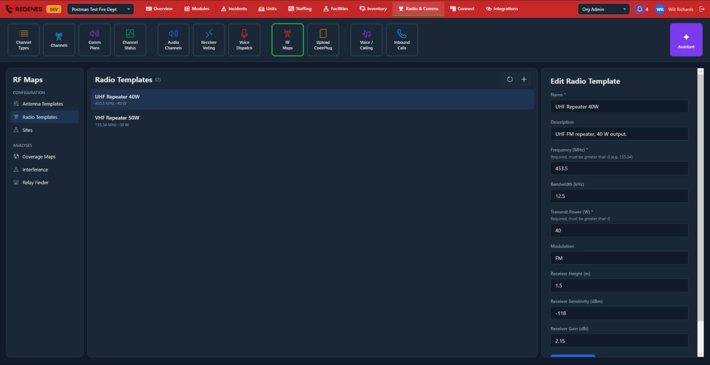 1
The fields 1: Name, Description, Frequency (MHz), Bandwidth (kHz), Transmit Power (W), Modulation, and the receiver's height, sensitivity and gain. Scroll down for Save Changes.
Sites
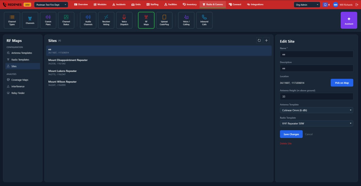 12345
- Name and Description 1.
- Location 2: click Pick on Map and click where the site is.
- Antenna Height, in metres above ground 3.
- The Antenna Template and Radio Template the site uses 4.
- Save Changes 5. Delete Site is below it.
Coverage Maps
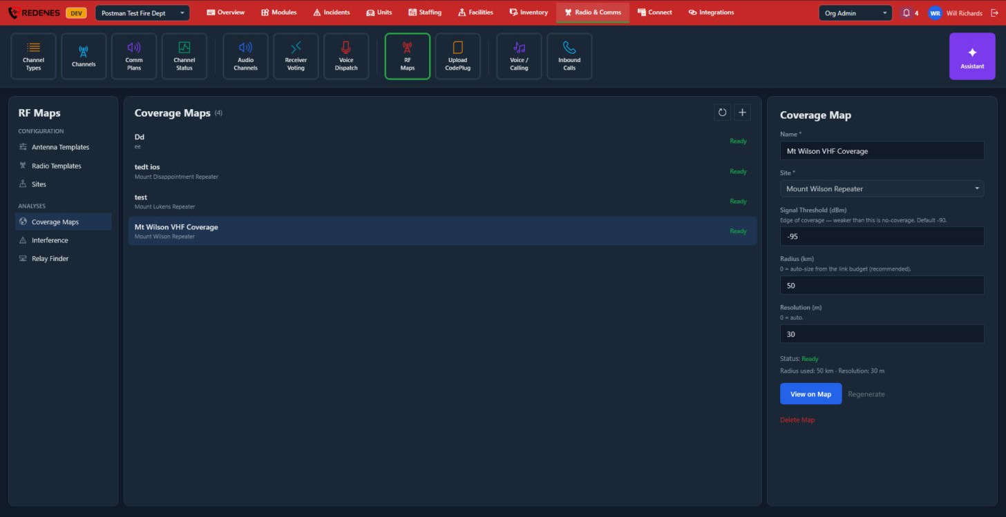 1234
- Name and Site 1.
- Signal Threshold (dBm), Radius (km) and Resolution (m) 2. Anything weaker than the threshold counts as no coverage. Leave radius and resolution at 0 to let REDENES choose.
- Status 3 reads Ready when the map has been worked out.
- View on Map 4 opens it. Regenerate works it out again after you change a site or template.
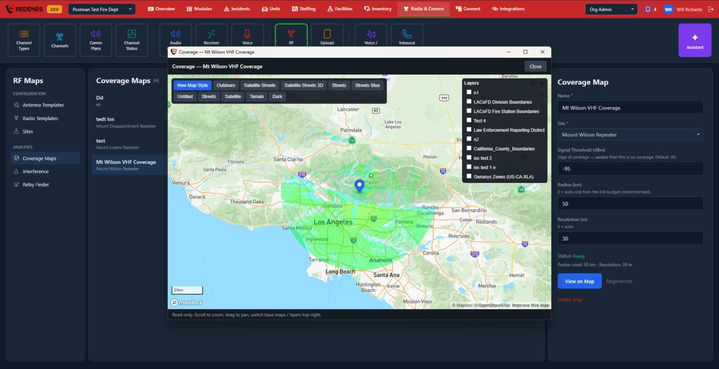 123
The coverage is drawn in green around the site 3. Change the base map 1, or tick your own map layers 2 to see coverage against districts and boundaries. This window only shows the map. Nothing in it can be changed.
Interference
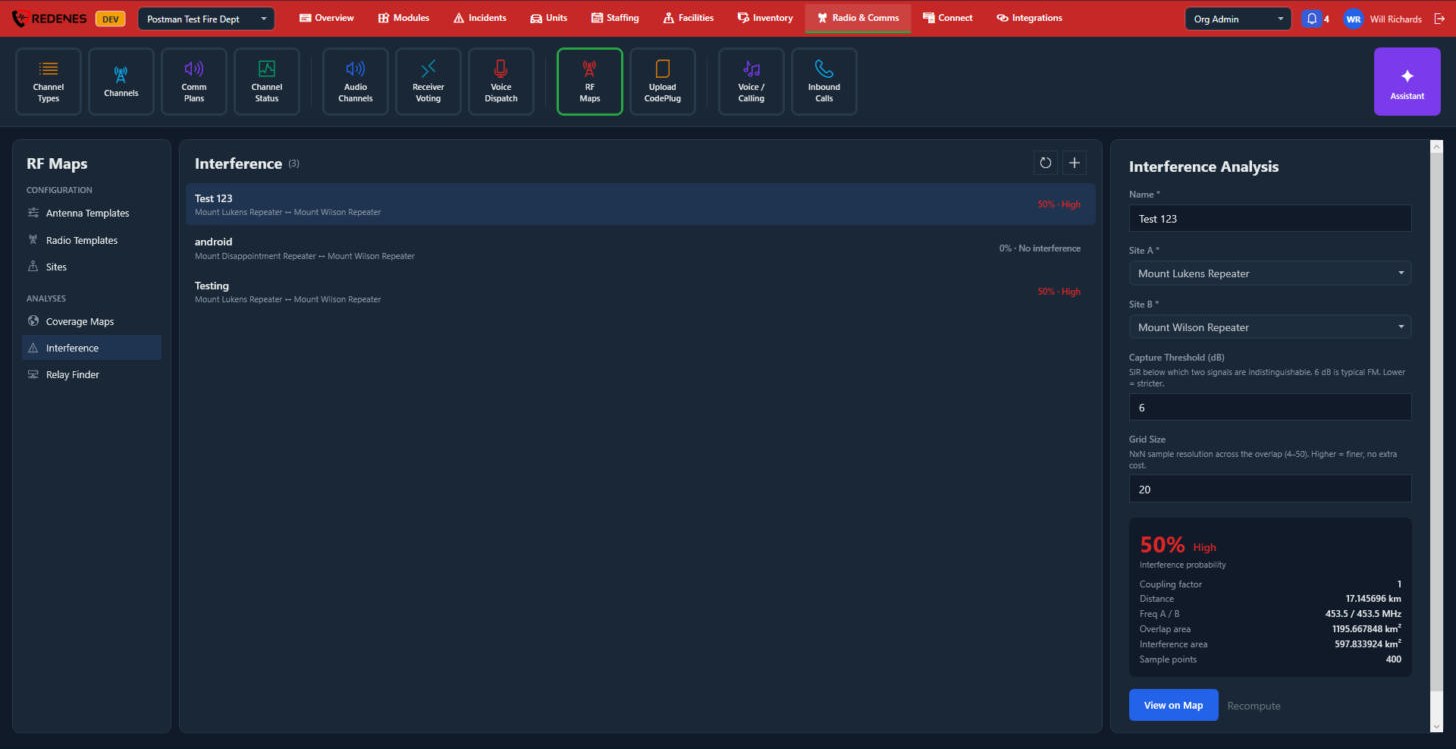 1234
- Name, Site A and Site B 1.
- Capture Threshold (dB) and Grid Size 2. 6 dB is typical for FM. A lower threshold is stricter, and a larger grid is finer.
- The result 3: the chance of interference, the distance between the sites, their frequencies, and the overlap and interference areas.
- View on Map 4, or Recompute after a change.
Relay Finder
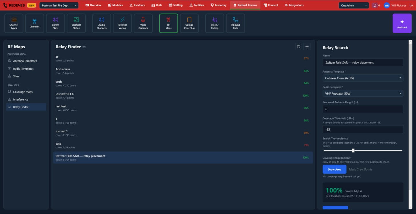 1234
- Name, Antenna Template and Radio Template of the relay 1.
- Proposed Antenna Height, Coverage Threshold and Search Thoroughness 2. A more thorough search tries more places and takes longer.
- Coverage Requirement 3: Draw Area to mark the area to cover, or Mark Crew Points to mark the places crews must be reached.
- The result 4: the share of the area or points covered, and the best location found. The list shows this percentage for every search.